AI powers India’s space ambitions: From debris tracking to autonomous satellites

")
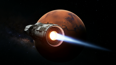
The growing presence of space debris around Earth is pushing space companies to rely on artificial intelligence (AI) to protect satellites and critical missions.Even a tiny fragment of debris can cause serious damage when travelling at extremely high speeds in orbit. Experts estimate that more than a million objects measuring one centimetre or larger are currently circling the Earth. These objects are continuously tracked to prevent potential collisions that could threaten billion-dollar space missions.Indian space engineers, along with global counterparts are increasingly using AI to monitor these objects and predict possible collisions with operational satellites and other space assets.Anirudh Sharma, founder and CEO of Digantara Industries, said that satellites frequently receive close-proximity alerts.“There have been a lot of cases where at least per year, we have seen more than 15 conjunction, close proximity warnings for a single 50-kg satellite,” he told PTI.Digantara works in the field of space situational awareness, which involves tracking active and defunct satellites, fragments from broken spacecraft and even asteroids passing near Earth.Explaining the process, Sharma said, “When we do space domain awareness, we primarily track objects. It is important for us to know where this object will be, let’s say, seven days later, for which we currently use statistical models because they are proven and have been adopted for ages.”He added that the company has developed AI-based software to detect patterns and assess risks in orbit. “As orbital congestion rises, India’s emerging focus on space situational awareness and debris monitoring underscores why trustworthy AI is now a safety imperative, not a nice-to-have,” Lt Gen A K Bhatt (retd), Director General of Indian Space Association (ISpA), said.Beyond debris tracking, AI is also transforming satellite imaging and data analysis. Bengaluru-based start-up Pixxel Space uses AI to process the large volumes of imagery collected by its Earth observation satellites.“I think artificial intelligence is very well suited to a data set like satellite imagery because there are petabytes and petabytes of this data that no human can possibly sit down and go through,” said Awais Ahmed, founder and CEO of Pixxel Space.According to Ahmed, AI systems can analyse data to detect small changes related to border security, agriculture, crop yields, oil and gas leaks and pollution. Pixxel has developed an AI platform called Aurora, which combines high-resolution, hyperspectral, SAR and multispectral data to provide a comprehensive view.He also highlighted future possibilities. “Being able to just put GPUs and compute on satellites and launch quite a few of them and utilise the free solar power that you get there, we could take images of a certain area, completely analysed in orbit and only the report or the insight can be downlinked,” Ahmed said.Sharma said AI could also enable autonomous satellite operations. “One of the things that we are very keen on is autonomous satellite operations, which means if there is debris or an active satellite coming close to you, it should automatically learn that there is an object within a certain vicinity and then tend to avoid a collision,” he said.Digantara is developing algorithms that can be installed on future satellites, allowing them to communicate and avoid collisions independently. “It will definitely become a reality in the next five years because autonomous satellite operations will be key to ensuring the sustainability in the orbits that the satellites are being operated at this point in time,” Sharma added.AI is also being integrated into geospatial technologies. Esri India has announced a Rs 150-crore investment in a GIS and AI Competency Centre in Noida.“Our new GIS and AI Competency Centre in Noida, backed by an investment of Rs 150 crore, brings together AI specialists, data scientists, and GIS experts to develop intelligent solutions that empower our customers to extract richer insights from complex geospatial data, automate routine workflows, and make faster, more informed decisions,” said Agendra Kumar, Managing Director, Esri India.Rupesh Kumar, Chief Technology Officer and co-founder of Suhora Technologies, said that the company uses AI to automate imagery classification and detect changes in terrain and infrastructure. “Our algorithms automate imagery classification, filter low-quality data like cloud cover and detect subtle changes in terrain or infrastructure over time,” he said.He added that the firm is building predictive models to help users anticipate future trends. “Our mission is to simplify complex space analytics and make satellite intelligence accessible, scalable and actionable for every sector,” Kumar said.Industry leaders say that AI is quickly becoming central to India’s expanding space economy. Lt Gen Bhatt observed that AI helps companies design smarter missions and operate spacecraft more autonomously.Gautam Sharma, Managing Director of Viasat India, said AI is also reshaping satellite communications. “AI is rapidly reshaping the space and satcom sector from connectivity to cognitive infrastructure. In satellite communications, the biggest change is that networks are starting to learn from their own telemetry, using machine learning to spot anomalies early, predict congestion and service degradation, and automate troubleshooting so availability improves even as traffic and complexity rise,” he said.As space activity increases and orbits become more crowded, experts say AI will play a crucial role in ensuring safety, efficiency and sustainability in space operations.